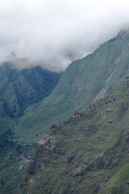
Showing posts with label Joshimath. Show all posts

April 27, 2009

Valley of Flowers: Reaching Govindghat


Following my Introductory Post, I shall continue to write hereinafter some more posts on the details of my journey to the Valley of Flowers.

Map borrowed and modified


Route covered so far:
DelhiHaridwarRishikesh – Devprayag – Srinagar – Rudraprayag – Karnaprayag – Nandprayag – ChamoliPipalkoti JoshimathAuli Govindghat


I take a night train from Delhi to Haridwar. Haridwar early morning is enigmatic. Then I embark on an almost 300 kms journey up the mountains that includes a morning stroll and a tuk-tuk ride to Rishikesh and a long bus journey of almost 6 hours via Devprayag and Srinagar to Rudraprayag for an overnight stay in the Government-run GMVN hotel.

The next day, in a ‘sharing taxi’ the rest of the journey from Rudraprayag through scenic Himalayan landscape keeps me spellbound through Karnaprayag and Nandprayag - at the confluences of the beautiful mountain rivers. The tributaries of the Ganges River gives company most of the journey. Reaching Chamoli, and overcoming the landslide episode, I reach Joshimath and have the choice to continue up to Govindghat. But something within me opts to stopover at Auli.

Locals chatting up - a long range shot from moving cable car


That has been a good decision I must say for the awesome experience in Auli from the time I ascend to the place in a cable car till I return through the same ropeway next morning.

Auli at 5:35 am

The trekking day begins on a beautiful morning from Auli. The Nanda Devi National Park is about 20 kms away from Joshimath, from where the trek to the Park can begin. A ‘sharing jeep’ that squeezed in about 10 people from Joshimath covers a distance of 21 kms to Govindghat. At each turning I feel like pulling out my camera and shooting photographs. But give up on the thought of doing so from the moving vehicle and then simply begin to enjoy the passing mountain scenery and the cool breeze.

Reaching Govindghat

I reach Govindghat and sit down to have some maggi noodles and tea as I am soon to commence the first leg of my journey to the Valley of Flowers by foot. From the window of the tiny roadside restaurant I can see the mesmerizing views of the majestic mountain and it is surprising to see quite a few people in this small mountain town.

Govindghat

I can see most of them are pilgrims who are either: going to or returning from the Hemkund Sahib, holy to the Sikh religion; or on their way to or from Badrinath, holy for Hindus. So Govindghat is an important junction for pilgrims of Hindu and Sikh religion. A minor road branches off as the roadhead towards Ghangaria, so it is an important point also for nature loving travellers like me heading to the Valley of Flowers.

Finishing tea, I walk the one kilometre stretch ambling through shops selling souvenirs, trekking gear, colourful warm clothing and a lot of fancy items to catch the eyes of tourists. I pass through the bridge under which the Alaknanda flows churning its waters into white foam.

View of Govindghat from a height

The rest of my plan for the day is to ascend a distance of 14 kms from Govindghat to Ghangaria to reach before sunset, and after a night’s rest to trek further right into the Valley of Flowers early next morning.


To be continued...

How to Reach Govindghat:

By Air: The nearest airport is the Jolly Grant Airport in Dehradun at a distance of approximately 270 kms.
By Rail: Rishikesh is the nearest Railway Station to Joshimath, which is at a distance of 250 kms connecting to all the major cities of India.
By Road: Govindghat can be reached via Joshimath which is well connected by surface network with Dehradun, Haridwar, Rishikesh and Nainital.


November 20, 2008

Garhwal: Joshimath

Route:
DelhiHaridwarRishikesh –Devprayag – Srinagar – Rudraprayag – Karnaprayag – Nandprayag – Chamoli – Pipalkoti - Joshimath - Auli


Road transport to reach Joshimath is not particularly in good condition. However, as I wrote in my previous post, the scenery of the mountains slopes and the Rivers Alaknanda, Dhauliganga and the other tributaries of The Ganges flowing along the narrow mountain roads more than makes up for the lack of comfort.

The view of the Himalayan mountains from every corner in Joshimath is lovely, and it was pleasant weather on that July afternoon. After roaming around the roads of Joshimath, I settled down to have some snacks and tea at a local teashop. That did give me a bit of tummy ache later which thankfully subsided with a couple of tablets by next morning.

The mountain town of Joshimath (also called Jyotirmath) is a hill station located at an altitude of 6,000 feet in the Chamoli district of Garhwal Division. It is considered as one of the four great "maths" or monasteries established by the great Adi Guru Sri Shankarcharya in the 8th century AD.

Joshimath is the gateway to the ski resort of Auli and resting point for travellers prior to embarking on a journey to Badrinath, Hemkund and the Valley of Flowers. The people of the upper mountains regions of the Himalayas come down to settle in the town of Joshimath when roads are closed during winter when it snows heavily. Joshimath is the winter shrine of Badrinath during the six snowbound winter months in the region.
Mountains as seen from the tea shop

Though I travel with a tentative itinerary, often I do not make concrete plans and hotel reservations. This way I get a chance to be ready for the unexpected and it does often lead to the most unforeseen events during my journey. In Joshimath it was the accommodation I managed to arrange at Auli. I had not made any prior hotel reservation at Joshimath as I was hoping to reach and stay at Auli overnight in case I could reach there before nightfall. Upon making some quick inquiries with the locals, I was pleased to learn that there was enough time to catch the cable car to Auli, 16 kms away from Joshimath.

The cable car ride begins from here

The operators informed me that the ropeway from Joshimath to to Auli is affectionately called Rajjo by the locals and spans a distance of more than 4 kms. I could count up to 10 towers of self-supporting steel structures. It is said to be the longest ropeway in Asia and the ride usually lasts 22 minutes till the eighth tower but I had a ride till the tenth tower as I was delighted to arrange accommodation at the highest point in Auli. A ride in the cable car costs Rs. 500 (about US$10) for a two way ride, and one of the requirements was to inform the authorities in advance of the time of the return ride.
The small strip of road seen leads to Auli

During the cable car ride, it was a fabulous feeling to enjoy the fresh mountain air brushing past my face and it was a feast to the eyes to view the scenery from that height. The route was lined with forests and lush green mountain vegetation. I could imagine how the slope would be in the winter months. It did seem like a perfect haven for adventure lovers. I made up my mind to return there sometime in winter to enjoy some winter sports.

View of a road in Joshimath from cable car

How to Reach Joshimath:

By Air: The nearest airport is the Jolly Grant Airport in Dehradun at a distance of 270 km.
By Rail: Haridwar is the nearest Railway Station to Joshimath, which is at a distance of 260 km connecting to all the major cities like Delhi, Lucknow, Moradabad etc.
By Road: Joshimath is connected by surface network with Dehradun, Haridwar, Rishikesh, Nainital and Almora.


Recent Travel Posts:

November 9, 2008

Garhwal: Chamoli Adventure

Map borrowed

Route covered so far:
DelhiHaridwarRishikesh –Devprayag – Srinagar – Rudraprayag – Karnaprayag – Nandprayag – Chamoli – Pipalkoti - Joshimath

Heading towards Karnaprayag

From Rudraprayag, my tentative plan for the day was to reach Joshimath about 120 kms away (which through the mountain roads can be a journey lasting 5-6 hours) and if possible, to take a cable car for a night halt at Auli.

Most of the people heading this route are pilgrims who travel in their private vehicles. For the remaining few, like me, who wish to travel the tough way seeking a sense of adventure, a word of caution is to begin the onward journey from Rudraprayag early in the morning, as I was told no vehicles would be available to go higher up the mountains after noon. In any case, driving in those narrow mountain roads after sunset is not allowed, so travellers ought to plan the day of travel well in advance and start as early as possible.


It was an early morning in Rudraprayag when I started the journey in a local 'sharing taxi' that was to take me first to Karnaprayag. Karnaprayag, the place of confluence of Rivers Pindar and Alaknanda, is the junction to change route from Garhwal to Kumaon and from here, one can reach the hill stations of Almora, Nainital etc.

Once at Karnaprayag, I had to change to another vehicle that would take me to Joshimath. It was here that I heard the locals murmuring something about a landslide on the road uphill. With the adage “I’ll cross the bridge when I come to it” in mind, I ventured to continue the journey unaware then that I'd actually be in need of a bridge later during the day.

Roadblock in Chamoli

Close to Nandprayag while nearing Chamoli, I came across a huge line of vehicles extending for kilometers. There was indeed a landslide and it had blocked the road completely! Neither movement of vehicles nor walking across the landslide rubble was possible. I could see from a distance 'Public Works Department' workers were busy using bulldozers to clear up the place to make way for the traffic to resume.

I am now talking of possibly being stranded at a height of about 8,000 feet above sea level. Roadblocks in the rainy days on these mountain roads last for a minimum of hours, sometimes even days together! A part of the thrill of going to such places is to travel with the right company. When there are like-minded fellow travellers in a group, it is easy to make quick decisions. So in this case a decision was made in a matter of couple of minutes to trek to the other side of the road. And then the adventure began.

Seated at the edge of the stream

It was just past twelve, and in spite of the cool mountain breeze, the sun was right overhead and beating down on me mercilessly. In short, to avoid making this post long, on that bright sunny day, it was a walk down the valley carrying my backpack on this unplanned and unprepared part of the journey in the Himalayas. At first it was a trek downhill, then it was crossing a stream - minus shoes - flowing with almost freezing waters with strong currents with the help of locals, and finally a steep climb up the rugged path to eventually surface on the other side of the road. Finally it was an easy walk on the Himalayan mountain roads until, at length, a local bus was getting ready that somehow managed with great difficulty in the narrow road to take a U-turn to carry some passengers up to Chamoli.

Taking leave of the locals who helped

From Chamoli it was an uneventful journey passing through beautiful mountain scenery crossing Pipalkoti to finally reach Joshimath.
View from Joshimath roadside

In every walk with nature one receives far more than he seeks

- John Muir

Recent Travel Posts:

August 16, 2008

Journey to Garhwal

Highlights of the Journey

July - August, 2008


  • While on the way from the airport to the residential parts of Delhi early morning, an interesting sight of the water-carrying, orange-clad kanwarias carrying decorated paraphernalia on their shoulders.

Kanwarias of Haridwar

  • Alighting from the Mussorie Express early morning, a walk on the streets of Haridwar towards the banks of the river Ganga amongst more Kanwarias, and many pilgrims, young and old, and when compared to those, a few tourists. Surprise at the sight of the huge number of pilgrims at the Hari-Ki-Pauri, most of whom seeking absolution early morning with a dip in the sacred river, The Ganges.

Pilgrims at Hari-Ki-Pauri at 7:20 am

  • After a walk up to the great Shiva statue, onwards to Rishikesh, the Yoga capital of the world, for a leisure walk to Ram Jhula, the ghats and beyond to discover the charm of the place to end up with a hearty breakfast at Chotiwal.

Ram Jhula, the bridge over River Ganges

  • A journey through the foothills of the Himalayas passing through scenic Devprayag, where lies one of the five sacred confluences when the Bhagirathi River joins the Alaknanda River to form The Ganges.

On the way to Devprayag shot from a moving bus

  • The journey for the day to continue right up to Rudraprayag, another confluence where the Mandakini River originating from Kedarnath joins the Alaknanda that originates from Badrinath.


The confluence as seen from the balcony of the GMVN

  • The mostly uphill journey to Karnaprayag, the place of confluence of the Alaknanda and Pindar Rivers, another important pilgrimage spot for many.

From moving cab, on the way to Karnaprayag

  • Roadblock lasting hours due to landslide between Nandaprayag and Chamoli and an unexpected mini-trek with the backpack to the base of valley, and then to cross a mountain stream - with gushing waters with fairly strong currents - with the help of locals and other travellers who ventured to undertake the difficult route through the wilderness. This was followed by a steep climb in the noon sun to emerge panting at the other end of the road for onward journey to Chamoli and was undertaken to avoid a long wait for hours for the roadblock to be cleared.

Unusual traffic on the road to Chamoli

  • Journey through beautiful scenery, where quite often the mountain road showed signs of recent landslides and cleared paths right up to Joshimath.
View of a road in Joshimath from cable car

  • A cable car ride to enjoy majestic and serene Auli and the joy of watching the change in hue of the mountain peaks at dawn for hours together till it was time to move on after an open air breakfast at sunrise.

A peek at Nanda Devi peak from Auli at dawn

  • The ropeway ride again to enjoy the morning vista up to Joshimath for onward journey to pass through more awesome mountain scenery till Govindghat.

A pause before the long trek from Govindghat

  • The thrill of setting out on the first planned long trek from Govindghat, passing through Bhyundhar village to end up hours later at the small mountain village of Ghangaria (also referred as Govind Dham).

Ghangaria

  • Rested and reinvigorated next morning, setting out on the much anticipated trek to the Valley of Flowers.

A small section of the almost 90 sq km of Valley of Flowers

  • Setting out on another trek - unplanned but certainly worth it - to Hemkund, a holy place for Sikhs, the valley having the most exotic mountain flora including the Brahm Kamal and the Blue Himalayan Poppy.

A glacier on a misty day on the way to Hemkund

  • Yet another trek returning from Ghangharia to Govindghat and then the beautiful scenery of the Himalayan landscape during the journey from Govindghat to Badrinath via Pandukeshwar and Hanuman Chatti.


Badrinath Temple

  • A final trek begun at dawn from Badrinath to the beautiful village of Mana at the borders with Tibet, and return to Badrinath.

On the way to Mana village


Return journey over the next few days from Badrinath to Govindghat – Joshimath – Chamoli – Rudraprayag – Rishikesh – Haridwar – Delhi – Mumbai and to my final destination.

~~~